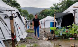
Revisiting Masara landslide
Masara landslide
The landslide occurred at around 7:50 p.m. on February 6. An estimated 9.8 hectares of land was buried by rocks, mud and trees that slid over 700 meters (2,300 feet) down a steep mountainside near the Apex Mining Co concession in Zone 1 of Barangay Masara.
At least 42 of the dead were residents including 26 mine employees. Among those initially reported missing were 45 gold miners employed by Apex who were waiting in three buses to be driven home at the end of one of three shifts for the mine’s 24-hour operation. At least 32 people were rescued from the debris and were injured, some of whom were bus passengers who had managed to jump out before the landslide hit. An official said that the height of the landslide was enough to “almost cover a two-story building.”
The landslide buried the transport terminal where the buses were located, as well as a jeepney, 62 houses, and the barangay hall of Masara. Most of the residents in the affected community worked either as miners or took jobs servicing the miners. The landslide also blocked a tributary of the Hijo River that traverses the village, raising fears of a flash flood.
Davao de Oro Governor Dorothy Gonzaga blamed the disaster on heavy rains brought by a shear line and trough of a low-pressure area that affected the Davao Region and other parts of Mindanao.
The Mines and Geosciences Bureau (MGB) said that the landslide was due to natural causes, particularly persistent rains in the area since January 2024. It also added that the area was among those in the fault line. An evacuation had previously been ordered in the area, but some residents returned to check on their belongings and prepare food.
The Incident Management Team (IMT) did not find any additional human remains in ground zero after February 18. As early as then, several groups of responders ended their efforts to participate in the operations.
On February 22, search and retrieval operations at the site were terminated following an executive order by Municipal Mayor Arthur Carlos Voltaire Rimando, as recommended by the IMT which reported the “completion of [clearing operations] at ground zero”.
Ninety-eight fatalities were recovered from the landslide, (excluding several body parts) while eight individuals remain missing, which are said among those still unidentified.
As of July 2024, Lea Añora, head of the Department of the Interior and Local Government – Region 11’s Management of the Dead and the Missing (DILG-MDM) cluster, said that all 88 casualties of the landslide had been identified and the municipal government had turned over the remains of the last eight of the 88 victims of the tragedy on July 5.
Authorities have designated Masara a “No Build Zone” following the devastating 2008 landslide. The Mines and Geosciences Bureau (MGB)-Davao has assessed the area as hazardous for construction.
Beverly Mae M. Brebante, chief of the Geosciences Division at MGB, confirmed that Barangay Masara was identified as a critical area as early as 2008.
“In 2008, we all know na nagkaroon na po ng ganitong klaseng paghulog ng lupa at covered part na po ng barangay Masara, yung original na barangay Masara dati, that is why it was already recommended na maging “No Build Zone” na siya (that there was this kind of deluge of earth, and it covered part of the barangay Masara, the original Barangay Masara before, that is why it was already recommended to be a “No Build Zone),” Brebante said.
She noted that the land in Barangay Masara is primarily composed of volcaniclastics, rocks broken down by volcanic activity and prone to erosion. According to Collins Dictionary, volcaniclastics consist mainly of fragments from volcanic eruptions, such as agglomerate and tuff.
Despite the “No Build Zone” designation, Masara is home to many residents, as well as barangay halls, schools, and mining companies.
During a House of Representatives hearing on March 12, 2024, it was revealed that the MGB issued geohazard certificates allowing local rebuilding efforts in Masara in 2017 and 2021.
Brebante said that after the 2008 landslide, the MGB has regularly updated concerned government offices on the situation and provided lists of barangays and puroks vulnerable to landslides and flooding.


