SEVERAL areas in Luzon were placed under Tropical Cyclone Wind Signal (TCWS) Number 1 as Tropical Depression “Gener” slightly intensified as it moved slowly over the province of Aurora.
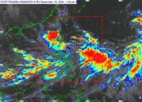
The Philippine Atmospheric, Geophysical and Astronomical Service Administration (Pagasa) said Gener was last spotted around 10 a.m. Monday, September 16, 2024, at 325 kilometers east northeast of Casiguran, Aurora with maximum sustained winds of 55 kilometers per hour (km/h) near the center, gusts of up to 70 km/h, and central pressure of 996 hpa.
It was moving “slowly” toward the west southwestward direction.
Under TCWS 1 were Cagayan, including Babuyan Islands, Isabela, Quirino, Nueva Vizcaya, Apayao, Kalinga, Abra, Ifugao, Mountain Province, Benguet, Ilocos Norte, Ilocos Sur, La Union, Pangasinan, Zambales, Tarlac, Nueva Ecija, Aurora, and the northern portion of Quezon (General Nakar, Infanta, Real) including Polillo Islands.
The weather system was forecast to cause heavy to intense rains over Cagayan, Isabela, Quirino, and Aurora in the next 24 hours and moderate to heavy rains over the rest of Cagayan Valley, the rest of Cordillera Administrative Region, Ilocos Norte, Nueva Ecija, and Bulacan.
Gener is also expected to enhance the Southwest Monsoon or Habagat, which is expected to pour heavy to intense rainfall in Palawan, Occidental Mindoro, Aklan, Antique, and Negros Occidental, while moderate to heavy rains may prevail over the rest of Mimaropa, the rest of Western Visayas, the rest of Negros Island Region, Quezon, Camarines Norte, and Camarines Sur.
Gener was expected to make landfall in the vicinity of Isabela or Aurora within the next 24 hours and may exit the Philippine area of responsibility (PAR) between late evening Tuesday, September 17, and Wednesday morning, September 18.
“Gener will likely cross the landmass of mainland Luzon as a tropical depression, although the possibility of reaching tropical storm category prior to landfall is not ruled out,” Pagasa said.
“Over the West Philippine Sea, Gener may reach tropical storm category by tomorrow evening or on Wednesday,” it added.
Meanwhile, the Pagasa is also monitoring Tropical Cyclone “Pulasan,” which was last spotted at 2,215 kilometers east of southeastern Luzon, packing maximum winds of 65 km/h near the center and gusts of up to 80 km/h.
Pulasan was moving north northeastward at 20 km/h.
The weather system was forecast to enter the PAR on Tuesday evening, September 17 and may exit PAR around on the morning of the next day.
“On the track forecast, Pulasan will remain far from the Philippine landmass and will likely remain within the PAR region until Wednesday late morning,” said Pagasa.
“After existing the PAR region, the tropical cyclone will move west northwestward towards the Ryukyu Islands and the East China Sea,” it added. (TPM/SunStar Philippines)


